


Auburn, Lee County, Alabama
About
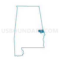
Outline

Summary
| Unique Area Identifier | 522277 |
| Name | Auburn |
| County | Lee County |
| State | Alabama |
| Area (square miles) | 59.52 |
| Land Area (square miles) | 58.64 |
| Water Area (square miles) | 0.89 |
| % of Land Area | 98.51 |
| % of Water Area | 1.49 |
| Latitude of the Internal Point | 32.58217700 |
| Longtitude of the Internal Point | -85.49093680 |
Maps


Graphs
Select a template below for downloading or customizing gragh for Auburn, Lee County, Alabama


Neighbors
Neighoring Voting District (by Name) Neighboring Voting District on the Map
- Beuaregard School, Lee County, AL
- Brownville VFD, Macon County, AL
- Farmville, Lee County, AL
- Little Texas Voting Center, Macon County, AL
- Loachapoka, Lee County, AL
- Opelika B Voting District, Lee County, AL
Top 10 Neighboring County Subdivision (by Population) Neighboring County Subdivision on the Map
- Auburn-Opelika CCD, Lee County, AL (80,779)
- Beauregard-Marvyn CCD, Lee County, AL (10,469)
- Loachapoka-Roxana CCD, Lee County, AL (7,236)
- Notasulga CCD, Macon County, AL (3,156)
- Little Texas-Society Hill CCD, Macon County, AL (1,403)
Top 10 Neighboring Place (by Population) Neighboring Place on the Map
Top 10 Neighboring Unified School District (by Population) Neighboring Unified School District on the Map
- Lee County School District, AL (56,237)
- Auburn City School District, AL (53,380)
- Opelika City School District, AL (26,477)
- Macon County School District, AL (21,452)
Top 10 Neighboring State Legislative District Lower Chamber (by Population) Neighboring State Legislative District Lower Chamber on the Map
- State House District 79, AL (52,950)
- State House District 81, AL (43,803)
- State House District 82, AL (43,389)
- State House District 83, AL (41,039)
Top 10 Neighboring State Legislative District Upper Chamber (by Population) Neighboring State Legislative District Upper Chamber on the Map
Top 10 Neighboring 111th Congressional District (by Population) Neighboring 111th Congressional District on the Map
Top 10 Neighboring Census Tract (by Population) Neighboring Census Tract on the Map
- Census Tract 411, Lee County, AL (9,042)
- Census Tract 417, Lee County, AL (8,528)
- Census Tract 405, Lee County, AL (7,652)
- Census Tract 410, Lee County, AL (7,236)
- Census Tract 404, Lee County, AL (6,960)
- Census Tract 421.02, Lee County, AL (6,826)
- Census Tract 409.02, Lee County, AL (5,201)
- Census Tract 406.04, Lee County, AL (5,146)
- Census Tract 402, Lee County, AL (5,133)
- Census Tract 406.02, Lee County, AL (4,152)
Top 10 Neighboring 5-Digit ZIP Code Tabulation Area (by Population) Neighboring 5-Digit ZIP Code Tabulation Area on the Map
- 36830, AL (33,201)
- 36801, AL (22,214)
- 36832, AL (22,071)
- 36804, AL (16,861)
- 36849, AL (3,150)
- 36879, AL (2,114)